Geographic Information System (GIS)
Relying on the latest technology is vital for the management of the Integral Water Cycle. For this, Aigües de Catalunya uses a Geographical Information System (GIS), which exploits all supply and sanitation networks.
The GIS is the tool which integrates and adapts all cooperative systems and those whose functions relate to the daily management of the supply like the Distribution Management System and the Maintenance Management System.
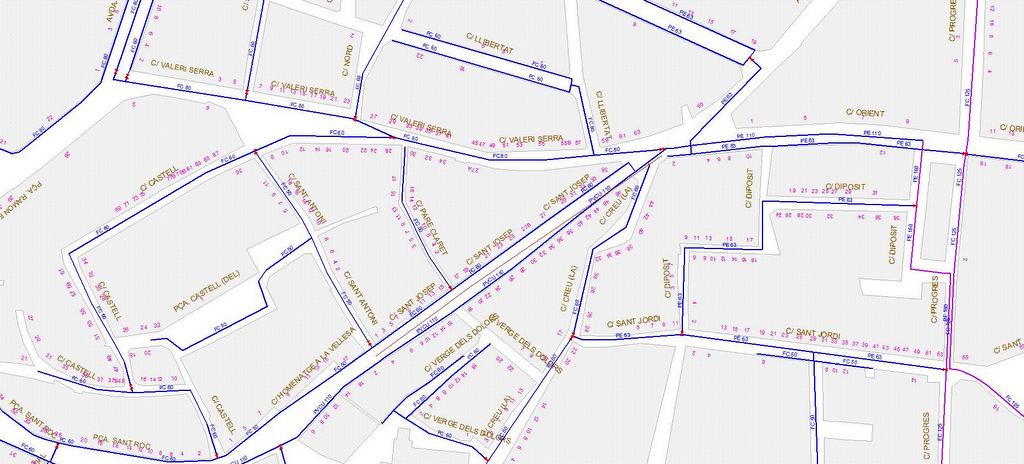
The GIS is the system where all information which concerns hydraulic infrastructures and where the geographic location is related to the elements, its topology and its technical characteristics is updated. The GIS represents the nuclear centre of graphical and alpha-numerical information about the Network Management System.
Consulting the situation of the supply system is done via a standard navigator. In this way access to information is facilitated from any point of the internal network of our users and from the internet to our clients.
Among its functions are the following:
- Advanced enquiries about the network inventory: longitude of networks, number of hydraulic elements per type and ratios.
- Generation of thematic maps which offer a graphic representation of the technical characteristics of the infrastructures.
- Printing of planes via assisted templates which will simplify the configuration process.
- Longitudinal profile of the networks and management of the spillage basins.
- The link between information with documents, photographs etc.
- The incorporation of raster cartography and colour orthophotograms
- 3D models via irregular triangular networks and digital Earth reference models.
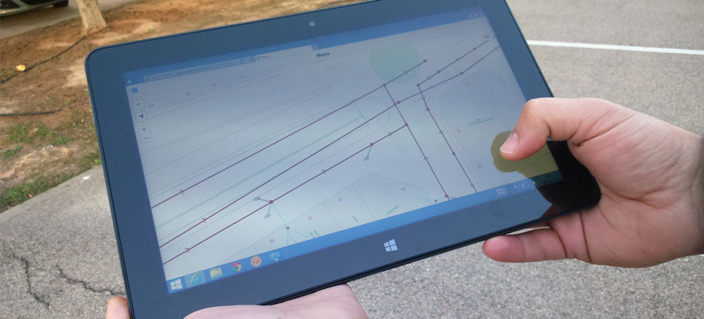
- GIS mobility allows for consulting relevant information about the water supply system in real time via special laptops.
- The localization of elements via the integration of GPS systems.
- The connection with mathematical models (EPANET and MOUSE).
- New management possibilities within networks thanks to connection between supply connections represented in the GIS and the Client Management System, which allows for the integration of other models from the Society of Reciprocated Guarantee.